From May 15th to May 22nd Jerry and Odette rode day trips on the tandem out of Bend, Oregon.


Back around the beginning of 2024 Odette and I settled on a tandem trip to Scandinavia in 2024 – the thinking being that we ought to get in some more trips like that while we still can. In that connection I pushed for some more local rides east of the mountains and went so far as to list out several possibilities (Selkirks, Okanagon, Coeur d’Alene trail, etc.) The Travel Oregon website had several multi-day routes and I had long entertained the idea of a trip that would include Crater Lake. One of the options I listed was a group of official scenic bikeways near Bend – all of which were about 35 miles long and none of which had more than a couple thousand feet of elevation. Predictably, Odette chose that one.
I booked a night at the River Run lodge in Maupin, followed by five nights at the Mill Inn in Bend. (I had saved a bookmark for the Mill Inn almost ten years ago and kept seeing it in the bike vendors folder just waiting for a trip to Bend. ) I had been dealing with dizziness and arm stiffness but started ramping up my mileage thinking about an upcoming trip. Odette didn’t get back on her bike until April – the first zero tandem miles quarter for us in years as our first tandem ride since October in Portugal was on April 13th.
We did some old favorite rides, like the Centennial Trail and the Foothills Trail, and finally got comfortable on the tandem again. We did a ride around Lake Sammamish with Alex and Carrie where Alex warned us that McKenzie Pass might not be open and recommended the ride across the dam out of Prineville. I replaced the improvised brake spring on the front of the tandem with a pair of Paul’s Components springs that were too big but which seemed to work just fine. I tightened the headset a little after the first couple of rides but the bike seemed to be fine mechanically.
In early May Odette ran the car into a low-hanging parking garage pipe and messed up the roof rack. I disassembled the Yakima stuff and put the factory rails back together. It seemed that one of the clamps holding the Yakima bars to the factory rails was trashed, but the tandem topper itself wasn’t damaged. I was able to use pieces from my parts bin to mount the tandem topper directly to the factory crossbars – a good outcome from my perspective. For the past several years the pivot bolt in the tandem topper has been loose allowing movement in the QR mount and permitting the bike to sway much more than was safe. My solution was to use a top tube adapter as a strut with a webbing strap tying the bike back against the strut to eliminate movement. With the tandem topper mounted on the Yakima bar directly over the factory rail (as instructed by the manufacturer) the adapter fit with one end on the spare tire clip in the basket and the other end on the top tube of the bike. With no Yakima roof rack I had no clip to anchor the adapter – so I moved the tandem topper inboard and clipped the adapter to the factory rail. This had the major disadvantage that the carrier ended up pretty much in the middle of the roof and loading the bike meant lifting it up and leaning halfway across the car. I reverted to positioning the carrier as close to the factory rail as the mounting hardware would permit and clamped a Yakima bar to the factory crossbars at a point where the adapter would fit. Once I was convinced that the configuration would work I replaced the u-bolt clamps with Yakima hardware and found a shorter bar that didn’t overhang as much in the back. Ten trips later I was still experimenting with rigging the webbing, but I’d figured out that a series of half-hitches wouldn’t loosen up.
I downloaded Ride With GPS routes for the five central Oregon scenic Bikeways from the Travel Oregon website. Since each one started in a different city I also downloaded the descriptive text for each bikeway in order to know how to get to the start in the event we didn’t have internet access. I also downloaded a spare RWGPS route starting in Sisters just in case we got there and found a McKenzie Pass closure.
We got up at our usual hour on the morning we were to leave. Temperatures in Bend at night were still in the 30s so we packed boots and lots of jackets and warm gear. Since we were driving we weren’t limited to carry-on size bags and we kind of loaded everything we could possibly need – but still ended up forgetting stuff like the powerbanks and mocha shots. I took a short ride and then loaded the tandem on the car. We took the route through Yakima and over Sherman Pass with a stop for lunch in Ellensburg. (We couldn’t find the place we used to go to on trips to Baker so we headed for the place we used to go with Kevin, which was closed – and finally got deli stuff at Safeway.) I hadn’t been to Maupin before and I liked the canyon but the town was small and scraggly (mainly fly fishing places) and I was worried about finding a place to eat.

It turned out not to be a problem – the motel up the road from our place had a restaurant (which was pretty good) and we found a nice bakery for breakfast. The park where the route started wanted $10 for parking – if you could find the attendant.
Sherar’s Falls Scenic Bikeway – Travel Oregon
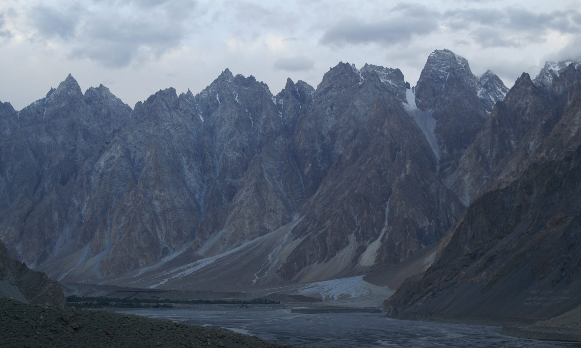
Our ride climbed up through town from the river to the plateau. It was intimidating but not nearly as bad as we’d imagined from the drive down. It was warm and sunny. The mountains were spectacular. The canyon was cool. I saw a big snake (dead.) We opted not to ride the 100 yards to see the White River falls. The descent was over blown in the narrative, but the river at the bottom was amazing (the big surging watercourse we’d eaten dinner beside the night before got crammed into slots that looked narrow enough to jump across. It seemed like we were on Indian land and all of the pull-outs were day-use-only and pay -for-parking. On the other side of the river we rode past six or eight free BLM campgrounds.
After the ride we drove 90 miles to Bend and found the key to our B&B. We walked to “Market of Choice” – a Whole Foods knockoff – and bought grapes and cherries and some instant coffee because Odette had forgotten the mocha shots she’d bought for morning caffeine. We walked a few blocks to the old downtown and found almost nothing that we recognized from our last visit in 2007. We ate at the Deschutes Brewery where neither the beer nor the food was as good as we remembered – perhaps because I’d eaten all of the grapes before dinner. I locked the bike to the car and plugged the helmets into the charger before we went to bed.

Breakfast was at 7:30 and featured a well curated soul music selection and crispy bacon. Heading out we were greeted by a note on the car asking us to park between the lines. The drive to Prineville took over an hour but finding the park where the route started was not a problem.
Crooked River Canyon Scenic Bikeway – Travel Oregon
What was a problem was the discovery that we had forgotten our helmets and gloves and my pills. I was ready to proceed, assuming that there would be little traffic on a weekday in May, but Odette refused and got ready to drive back to Bend. Luckily I remembered that the narrative about the trip mentioned a bike shop in Prineville and I convinced her to go to the store and buy new helmets. The place was open and the guy behind the counter told her we didn’t need helmets – but sold her a pair anyway. He also said that they had been repaving McKenzie Pass a few days earlier and he wasn’t sure if it would be open to cyclists yet.
The ride was great – no navigation, no traffic, almost no climbing. It was warm and sunny and pretty much perfect biking weather. I did, however, forget to bring the frame pump that I’d put in the car. The Travel Oregon website and the RWGPS route had us stopping at a campsite shortly before the dam. The bikeway sign at the park had the route going on just a little further and crossing the dam. I remembered Alex’s description and planted the idea that we’d consider continuing once we got there and took a look. We admired the layers of basalt and volcanic ash and kept waiting for the climbing to start. Eventually we got to the turnaround campground and decided to climb the rest of the way to the dam. Odette wouldn’t cross once we got there but from the other end you could see the reservoir and I determined that it was worth the trouble.
We drove back to Bend, I took my pill a few hours late, and we walked a few blocks to the Old Mill district for a dinner at Greg’s Grill. (The district is constructed around massive parking lots and feels more like University Village than like Whistler, but the trail along the water is nice.) The place was fun, the food was good, the beer was fine. As a topper to the day, Odette got a text from a neighbor saying that there was package on our porch and our deck umbrella had blown over.
I took my next pill after 8:00 – maybe four hours later than usual – and slept very well, making me think about a permanent rescheduling. In the morning I had waffles and noticed that the music was different but still remarkable.

Madras Mountain Views Scenic Bikeway – Travel Oregon
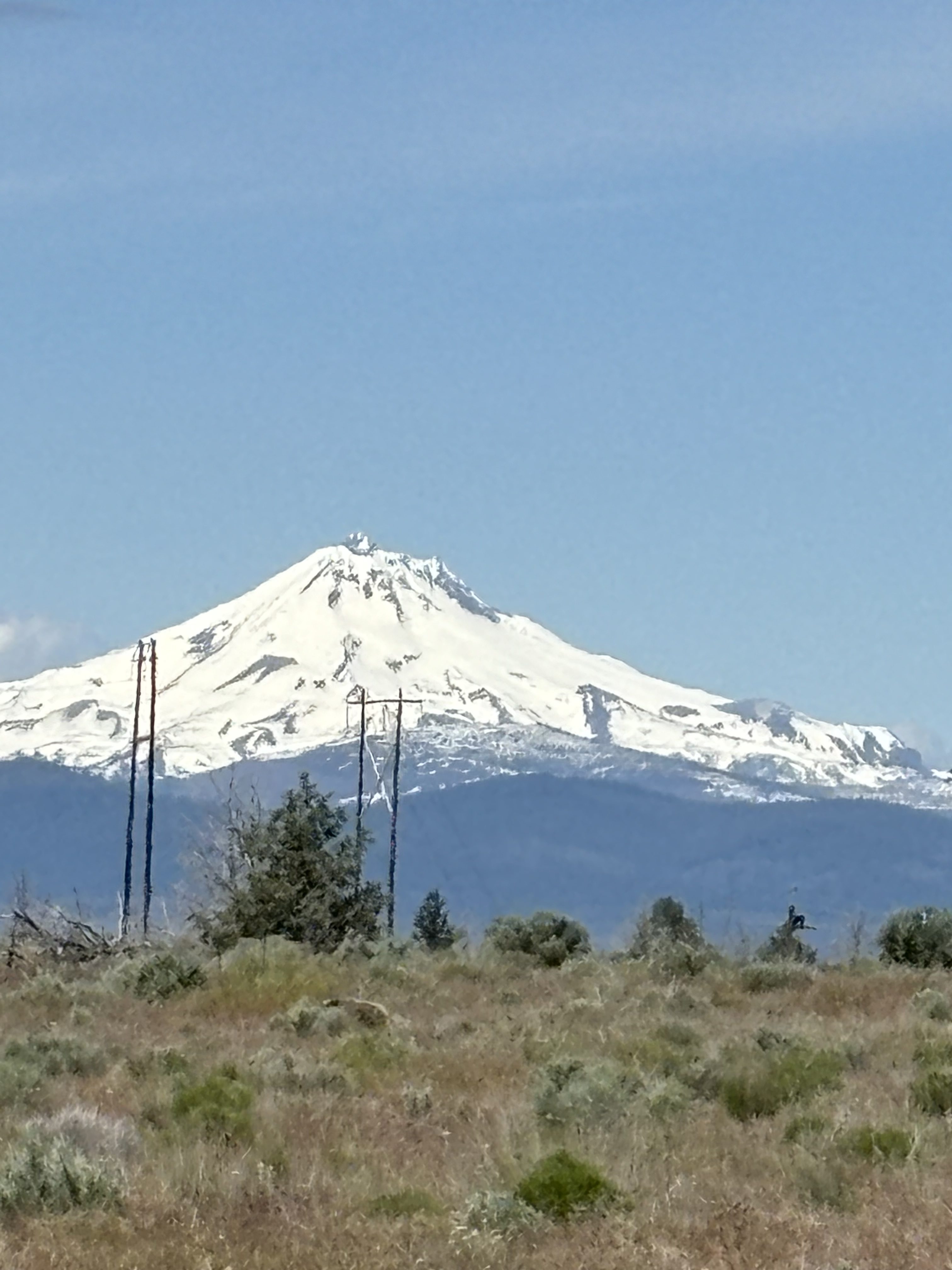
We drove to Madras after checking twice to make sure that we hadn’t forgotten anything. The little city park at the start was full of people and totally parked in. We eventually parked on the street next to another pair of cyclists who told us that they were there for a local club ride. They were following the same scenic bikeways route, but we deviated just before Metolius and we dropped them for good at one of the overlooks to Lake Billy Chinook. A little later, on a climb over the edge of Round Butte, we overtook another group who said they were camped at Cove Pallisades State Park. (They were all at least 40 years younger than us, so climbing faster after a winter layoff – on a tandem no less – was really reassuring.) We drove back to Bend and ate at Hola! – a Mexican / Peruvian place. The food was not spicy but good, the beer was exceptional (tranquilo especial, a Mexican style ale brewed in Bend.) We walked the old downtown some more and found at least one place that triggered memories. (New York after twenty years was not nearly as foreign as Bend after fifteen.)

Twin Bridges Scenic Bikeway – Travel Oregon
We had breakfast at the B&B – sticking to the waffles and listening to vintage rock, and then rode from the Inn on a route that started at Bends’ Mirror Pond. The route was a lollipop and the highlight was supposed to be two crossings of the Deschutes. For us it was the construction on the lollipop stem that made a traffic circle impassable and navigation around it pretty challenging – in both directions. It was also the most climbing of any of our rides, which might have entered into our assessment. I saw another three- or four-foot long snake – probably dead but without any obvious damage. The mountains were spectacular and although the weather was cooler it was still good for riding. We had a disagreement about which street to take to get back to the B&B from the mirror pond and we ended up depositing Odette at the door of a bike shop (where she was convinced that she had lost her glove.) The guy at the shop told her that McKenzie Pass was closed to both cars and bikes and would be closed for a while. Odette found her glove in our room and then paid another visit to Market of Choice buying a variety of snacks. We ate at Blacksmith and really enjoyed ourselves.

With McKenzie Pass no longer an option we debated a ride for our last day. Since they were predicting rain in Cle Ellum, there was an unspoken agreement that we’d do a long ride on Monday and skip the Ellensburg loop we’d talked about doing on our way home Tuesday. There is a scenic bikeway from Sisters to Smith Rock but it is over 30 miles one way and Odette wasn’t interested in 60 miles. I proposed riding the potion of that route from Sisters to Terrebonne but Odette looked at the map and realized that I was still talking something like 50 miles. After some more back and forth she found a RWGPS route from Sunriver to La Pine that was just under 50 miles but with virtually no elevation.
The commercial part of Sunriver had a bunch of new buildings and one of the traffic circles on the way to the public parking was under construction and impassable. We floundered around for a while but eventually parked the car and then got to repeat the traffic circle dance on the bike. The ride was flat with views of farms and fields on the way out and forest on the way back. We saw some elk early in the ride and a coyote near the end. The forest seemed really healthy. There was smoke from a controlled burn at the end of the ride.
We stopped at the Sunriver country store and bought ziplock bags and duct tape to wrap up the saddles for the drive back to the wet side. We ate at Bend Brewing where both the burger and the beer put Deschutes Brewing to shame. Bend Brewing didn’t have dessert, though, so we wandered around looking for some place to get pastries. We ended up in a funny little food truck court and eventually gave up, not realizing that the bakery we were looking for was apparently inside the beer place there.

So that was the end of the riding. Breakfast featured music from KEXP! It started raining just out of Redmond and kept it up all the way back to Seattle. We drove over Government Camp for variety’s sake and I remembered why I always go through Yakima. We almost hit a deer just west of the pass. Somehow Google Maps got us off I-5 south of Southcenter and then we missed a couple of turns before finding 509 and our way home. We had a lot of stuff to unload and tons of laundry after that. On the other hand, the wrapping kept our saddles dry. Our neighbor told Odette about watching the birds chase a raccoon out of our lilac while our umbrella was getting set back up.
Here are the photos:
Here are the maps:
5/20 – day 5 – map. Sunriver – La Pine loop. 48 miles
5/19 – day 4 – map. Twin Bridges Scenic Bikeway. 38 miles
5/18 – day 3 – map. Madras Mountain Scenic Bikeway. 30 miles
5/17 – day 2 – map . Crooked River Scenic Bikeway. 39 miles
5/16 – day 1 – map . Sherar’s Falls Scenic Bikeway. 34 miles
Here are some RWGPS routes:
Sherar’s Falls
Crooked River
Madras Mountain View
Twin Bridges
Sunriver – La Pine
McKenzie Pass
Sisters – Smith Rock
Here are some thoughts:
- day rides from a stable lodging is a model that works for us
- we could do this in Winthrop or Chelan or other towns east of the mountains
- the roof rack will work – it’s just going to be more work to mount a ski case
- I’m going to be glad for all those new bolts and for using Yakima wing nuts
- we need to get back to Bend to ride McKenzie Pass
- I need to take more photos